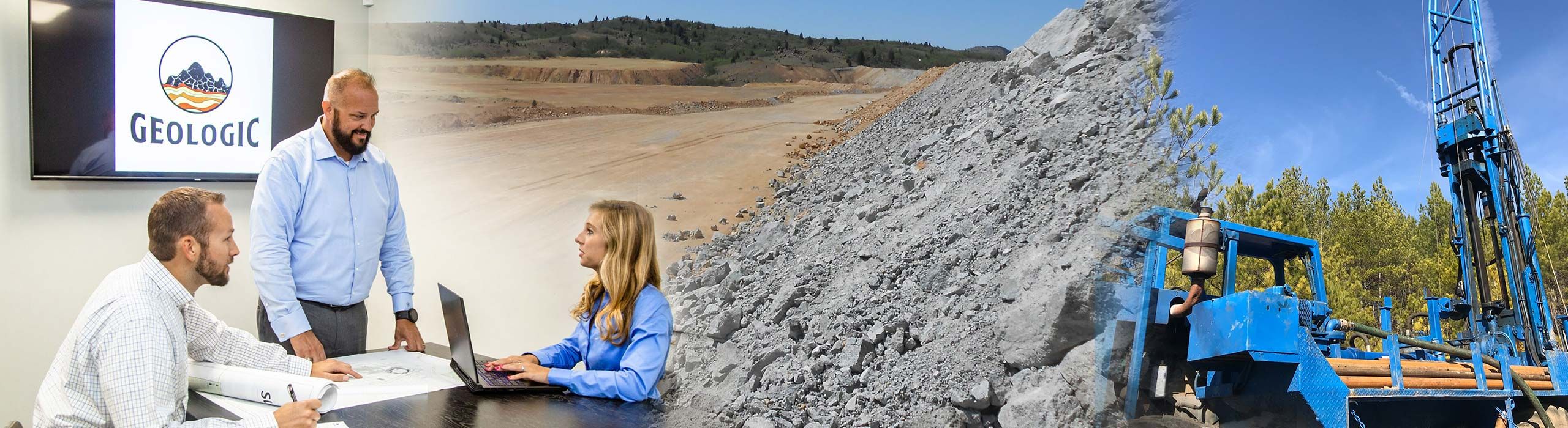
Services Overview
Geological Exploration & Evaluation
GeoLogic is a close-knit team of geologists, engineers, scientists, designers and technicians using our spectrum of education and training to effectively accomplish objectives across multiple disciplines. By applying technical expertise to natural geological systems in a wide variety of environments, the GeoLogic team achieves collaborative results. Our geologists investigate and analyze the complexities of earth materials and resources, while our engineers assess and apply these findings to human problems, determining quantitative properties and designing economic solutions.
Our experience includes geological exploration and mapping, mine planning and design, comprehensive environmental regulatory compliance, and permitting of surface mining sites. Our services include conducting mineral reserve and economic analyses, aggregate and other industrial mineral quality testing, geological mapping, and hydrology studies. We manage exploration and geologic evaluations at greenfield sites, as well as expansions on existing mine operations and strategic potential acquisitions. View examples of our team in action.
Laboratory Services
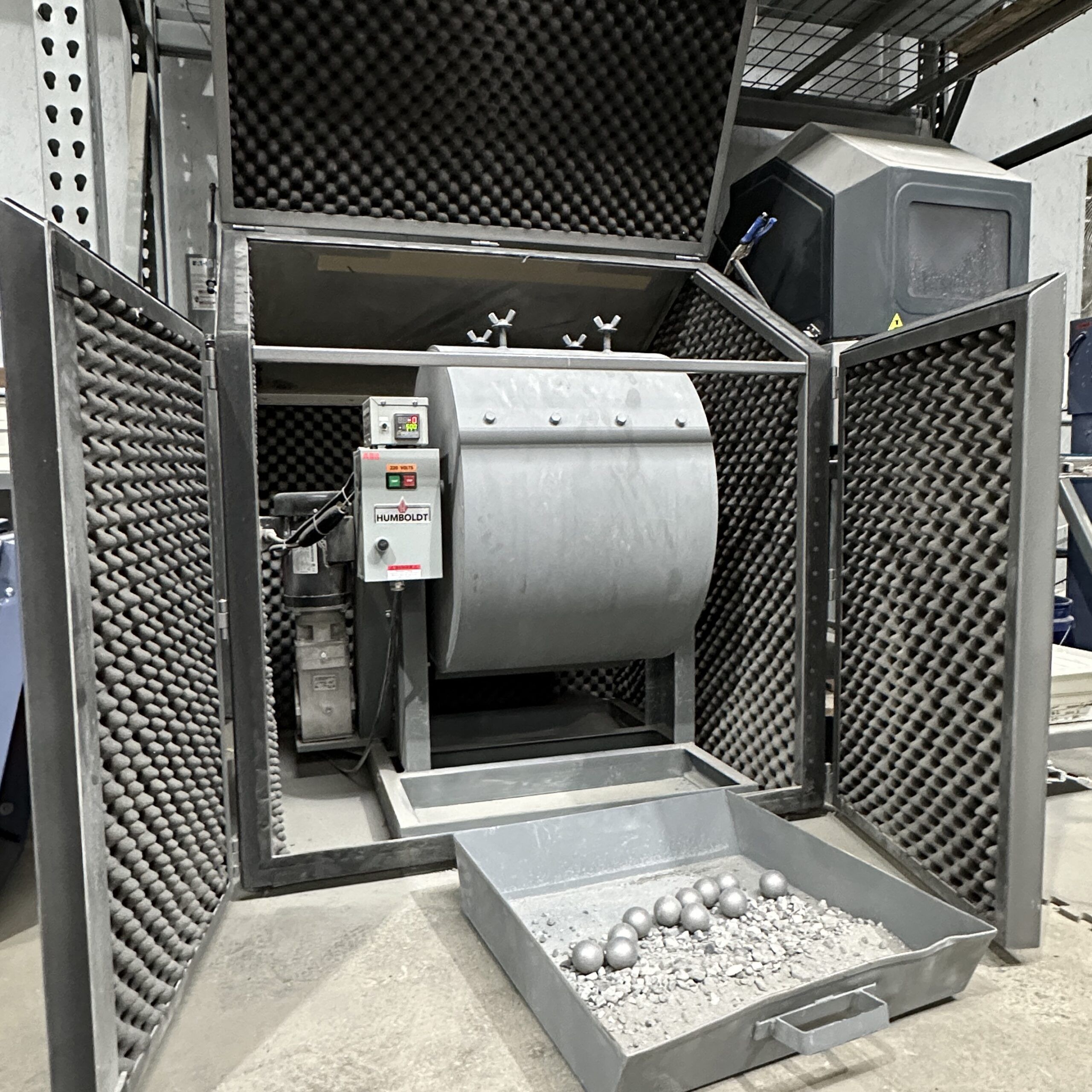
GeoLogic is proud to serve our clients with an AASHTO-accredited geotechnical and construction materials testing laboratory, specializing in aggregate testing that meets national and international specifications. GeoLogic’s laboratory is operated by our experienced and certified laboratory staff, with oversight from our PEs and PGs. We take pride in helping clients make informed decisions on new and existing projects, and look forward to assisting with your materials testing needs!
Surface Mining Land Use Plans

GeoLogic specializes in complete mine planning and permitting services, offering a wealth of experience in the development of new mine sites as well as the expansion of existing facilities. We provide a spectrum of assessments, studies, evaluations, and plans, including Resource and Reserve Assessments and Mine Feasibility Studies.
We also provide ecological field studies, including wetland delineation and protected species habitat surveys, as well as digitization of ecological resources using Geographic Information Systems (GIS). In addition, we facilitate requests for approved jurisdictional determinations (AJDs) from the Army Corps of Engineers, and coordinate with the US Fish and Wildlife Service to gain their concurrence regarding potential effects on protected species. Our mine planning and design is informed by cultural resource surveys conducted within 1-mile of the proposed project area, as well as threatened and endangered species surveys and project constraints analyses.
- Surface Mine Planning & Design
- Surface Mining Permits & Mining Land Use Plans
- NPDES Permits
- Air Quality Permits
- Groundwater Withdrawal Permits
Aerial Surveys & Photogrammetry

We provide highly detailed aerial mapping and data collection using the latest UAV technology and software. UAV-based data collection is typically safer and significantly less costly than a traditional survey or other ground-based systems. Our FAA-licensed pilots use survey-grade equipment and photogrammetry to collect and process data with a very low margin of error. We use high-end data processing stations and cloud-based solutions to provide the following: High-res 2D Aerial Mosaic Tiles, Point Clouds, 3D Surfaces, 3D Meshes, Complete 3D Models, Earthwork or Stockpile Volume Calculations, and 4k Video. View examples of our team in action.
Phase I & Phase II Environmental Site Assessments
In order to identify Recognized Environmental Conditions (RECs) that may be associated with a subject property, GeoLogic will perform a Phase I Environmental Site Assessment (ESA), consisting of a review of regulatory records (e.g., environmental database, local and state records, historical records), site reconnaissance including a visit to and inspection of the property, and interviews conducted with present and past owners (if feasible), operators and occupants of the subject property, and local and/or state government officials. We evaluate the presence, or absence, of petroleum products or hazardous substances in the subsurface of the site. Typically, a Phase I ESA does not include sampling or testing of air, soil, groundwater, surface water, or building materials. These activities would be carried out in a Phase II ESA, if warranted.
In order to identify Recognized Environmental Conditions (RECs) that may be associated with a subject property, GeoLogic will perform a Phase I Environmental Site Assessment (ESA), consisting of a review of regulatory records (e.g., environmental database, local and state records, historical records), site reconnaissance including a visit to and inspection of the property, and interviews conducted with present and past owners (if feasible), operators and occupants of the subject property, and local and/or state government officials. We evaluate the presence, or absence, of petroleum products or hazardous substances in the subsurface of the site. Typically, a Phase I ESA does not include sampling or testing of air, soil, groundwater, surface water, or building materials. These activities would be carried out in a Phase II ESA, if warranted.
Preliminary Desktop Reviews

Identification of potential constraints to future mining activities is often recommended early in the planning process. GeoLogic offers a preliminary assessment of environmental constraints, based on a desktop review of publicly available datasets that include potentially jurisdictional streams and wetlands, federal and state threatened and endangered species, floodplains and soils, and an overview of the relevant environmental regulations.
Engineering Evaluations for Dams

We have extensive experience with a multitude of dams, reservoirs, and levees, including those categorized as high-hazard structures. Benjamin Black, owner and Principal Engineer of GeoLogic, is recognized as an “Engineer of Record” by the Georgia Department of Natural Resources, Environmental Protection Division, Safe Dams Program. We provide routine quarterly dam inspections, as well as the annual and biannual inspections required by the Georgia EPD Safe Dams Program, conducted in accordance with guidance provided by GA EPD.
Slope Analysis & Design
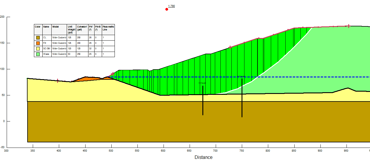
Our slope stability analysis includes identifying rockfall hazards and recommending slope stability mitigation methods as we assess global slope stability of anticipated mines. Slopes are evaluated using GeoStudio’s latest SLOPE/W® software. This program is also used to evaluate pseudo-seismic slope stability analysis and check for stability in the case of strong ground shaking from blasting and earthquakes. The analyses are conducted to determine the minimum acceptable Factors of Safety for long-term design. Subsurface conditions are obtained from data gathered in the field, results from the laboratory, rock mass classifications and rock engineering industry standards.
Rock Mechanics Evaluations
GeoLogic has extensive experience and technical expertise with excavation in rock. Our staff are dedicated to evaluating the rock mass and utilizing our knowledge of rock mechanics with respect to drilling and blasting and mechanical rock removal, monitoring structures for vibration and movement, and planning for excavations near highways, railroads, and occupied structures.
Our capabilities include designing plans for vibration monitoring, blast monitoring, seismographs, rock bolt pullout testing and monitoring, rock slope monitoring and stabilization recommendations, and deformation analysis using Finite Element analysis and traditional static analysis of rock masses.
With experience in mine and quarry operations, railroad construction, and transportation projects, we are uniquely skilled to provide our clients with the highest level of service and technical competence.
Groundwater Monitoring & Sample Collection
GeoLogic performs groundwater monitoring to determine the extent of groundwater contamination that is present at a site. The initial site visit includes purging and developing the wells in preparation for the required sampling. Once the monitoring well gauging is complete, the monitoring wells are purged and sampled using low-flow sampling techniques. Samples are collected and sent off to the laboratory for testing. Data is then analyzed, and contamination concentrations are reported. View examples of our team in action.